Friday, July 7, 2017

Faces on a wall


Some time ago we were talking about the places we wanted to visit and Mount Rushmore was on my list.  This was the real reason we came to Rapid City, this was the goal, yesterday was just a bonus.


I had assumed that Rapid City would be quite empty but the place was packed with tourists.  Apparently I was not the only one who wanted to see Mount Rushmore.  Coming in we had flown by the monument and it was about 5 minutes from there to the airport.  We were staying right by the airport and the drive back out was 35 minutes.  Sometimes flying is a whole lot faster, trouble is nowhere to land at the monument.


We arrived early to catch the good light, Rushmore faces Easterly.  The monument is free but parking costs $10 (I guess we could have hiked up from town).  It is popular, there are 2, 3 story garages.  The Monument is well designed.  You walk down a aisle that frames the carving until you reach the observation point.  From here you can walk a trail below the sculpture to get different views.


They also have a small museum with background on the design and construction.  After suitable gawking and picture taking we headed off for our next stop.  We had decided against the Crazy Horse memorial as it is still under construction and we had a good view the day before.  Our drive took us by where we could see it from the highway.


Our destination was Custer State park.  It happens to be by the town of Custer.  It was supposed to have lots of wildlife.  We entered the park and headed off on the wildlife loop road.  They have 1300 Bison in the park so we expected herds.


After a bit we happened by a bull or should I say he happened  by us.  We saw him coming down the road so we stopped to watch.  He came trotting right at us and walked by CC's side about a foot from the car.  After that we continued the search but came up dry.  A stop at the visitors center showed that the Bison had wandered off and were not easily visible.


We decided to drive over to town and get a snack and then do the Needles road.  Custer, SD is a small town that looks like it caters to the park tourists.  While we had only seen 1 Bison after driving for 90 minutes we saw several in town.  We parked at one end and quickly walked down main street and back.  Nothing grabbed us for lunch so we stopped at an old bank that had become a coffee shop and got Ice Cream cones for lunch.  Life is uncertain so having dessert first is always a good idea.


Our plan was to drive to the Needles road and take it back to the park core and then return to Rapid City on the Iron road.  We did this but added some detours.  The Needles road really showcases the Black Hills.  Now to be fair I would have called them the Dark Grey Hills but no one consulted me.


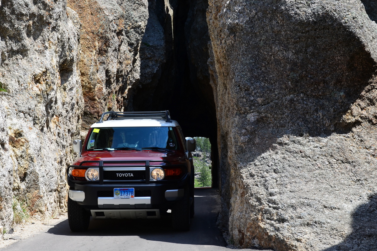
The highway winds through some incredible rock formations and there are two one lane tunnels through the hills.  We wound our way through stopping as we went to take in the views.


Coming off the Needles we stopped at the visitor center and found that the Bison had been sighted 25 minutes away in herd size numbers.  We decided to go take a look.  We did find some single Bison but no herds.  We took the opportunity to drive up another dirt road and get the car dirty again.  It was worth it though as we had a nice view.  We also saw some storms building on the horizon and decided it was time to head back.


We made our way to the Iron road which runs from Custer State Park to Mount Rushmore.  It is know for its views and cool highway design with loops and more narrow tunnels.  The skies were getting darker as we drove and while we did make a stop, we decided to push ahead.  This was a good move as the storms about caught us.


Heading back from the Black Hills into town we were finally pulling ahead of the storm.  What started as a few showers was now an organized line of severe weather.  We had left the plane tied down outside which is usually sufficient but with gusts of 50+ miles per hour coming I called the airport and asked them to put the plane in a hangar.  It costs a bit more but a while later we were in our room watching the storm rage and it seemed well worth it.

I'll leave you with a quick video clip of the narrow tunnels on the Needles and Iron roads.


Thursday, July 6, 2017

Rapid City South Dakota #43


On vacation I try not to be on a schedule but Monday we had booked a tour in South Dakota so we got going early (8AM mountain time) so that we would have plenty of time.  The tour only cost $6 so if we missed it, no great financial loss but it was one I wanted to see.


Leaving Denver was mostly easy.  I had filed an instrument flight plan and before departure you call for your clearance.  They read you your clearance limit, your route, initial and expected final altitude, squawk code (used for ATC tracking) and the departure radio frequency. I had filed pretty much  direct and up until now I had been getting the normal "as filed" route.


Today I got "Denver 9 departure, Radar Vectors, Gil VOR,  Victor airway 209, Scots Bluff VOR, Victor Airway 169, Rapid city VOR, Direct Rapid City.  Luckily my computer program understands all this and I had soon reviewed the Denver 9 which is 2 pages explaining I will turn right on departure to an assigned heading which they will tell me soon, I punched in all this data (yes punched as when we used to interact with computers using cards), confirmed it made sense and then sent it via Bluetooth to the primary GPS.


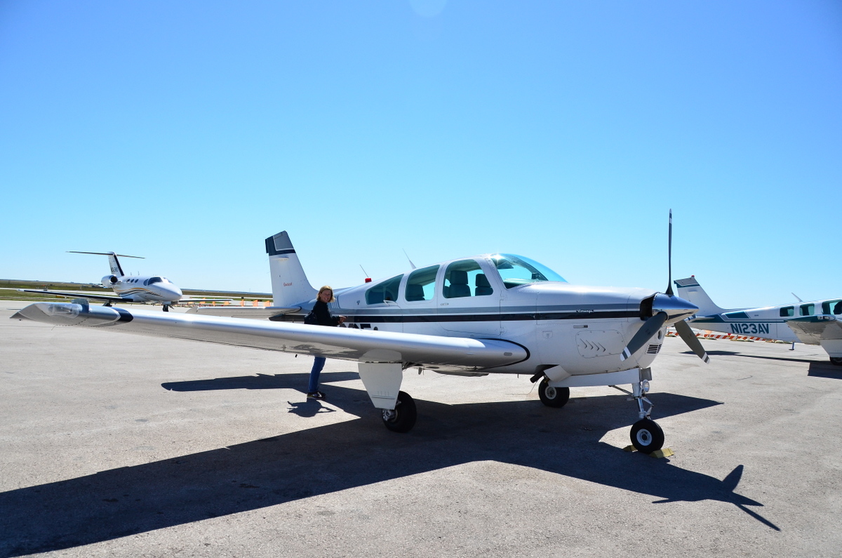
Now we were ready to go.  So on departure I was given an initial heading of 350 as expected and after a few miles the controller said, cleared direct Rapid City.  That basically wiped out all that work and all that programming.  In the end we did not go direct as once we were over Wyoming (note it did not count as we did not land), I requested a re-route to take us by the Crazy Horse and Rushmore monuments.


The controllers were very friendly and helpful and set us up for our sightseeing.  Around Rushmore you either need to maintain 7700 feet (about 2000 above the monument) or a 1/2 mile laterally.   We did both as I like to be a quite flyer and not bother the people on the ground.


We were nice and early and Avis dropped our car off so we were soon racing down the highway and I do mean racing, the speed limit is 80.  We were off to the Minuteman Missile National historic site.  You can book a tour of a launch control facility, like the one you saw in War Games.


On the way we stopped at the famous Wall Drug Store.  This is a place in the middle of nowhere and is like Rock City or South of the Border in that they have a gazillion signs.  We had lunch and enjoyed the attraction.


At the missile control center we  arrived early and met our ranger tour guides.  The tours are limited to 6 people at a time but the other family never showed.  Our ranger had been a missile officer so we scored a great private tour.  As he had lived the cold war I found his account quite interesting and informative.  We got to go down to the capsule where they stood watch ready to turn they keys to fire the missiles.


After our tour we went to the visitor center to see some more displays and then it was off to the badlands which were conveniently about 5 minutes away.  We are not by nature outdoors people.  We like showers and nice beds but we really do enjoy visiting nature.  We visited several national parks on this trip and they are incredible treasures.  The park service does a great job and they were always helpful and friendly.    I did not expect much of the Badlands but.....


They surprised me with their great beauty.  It is well worth the visit.  As an add on we drove down a 5 mile dirt road to see prairie dog town and several other animals.  I have never gotten a rental car this dirty.  I felt bad enough that I actually paid a few bucks to run it through a car wash that evening as I was embarrassed to bring it back so dust encrusted.


One thing about flying yourself is you have no luggage limitations as in we can haul over 200 pounds easily.  We had well under 100 pounds but still were over packed.  We took a few minutes to consolidate our clothe into one bag so we could leave the extra in the plane.  After a nice steak dinner we called it quits for the day and got some rest.


Wednesday, July 5, 2017

Making it real


Going to sleep, the weather looked like we may have issues but at 5 AM I awoke to start checking things and I lucked out with great weather.  I met my instructor a bit early and after some planning we were climbing out to cross the Front Range through Rollins pass at 12,500.


I previously mentioned that the plane does not breathe well up high due to the decreased amount of oxygen.  This applies to people too and for safety the FAA limits pilots to 12,500 but you can exceed this for 30 minutes up to 14,000 without supplemental oxygen.  Above 14,000 you always need oxygen, helps you keep thinking and living.  Since I do not have an oxygen system, this was one additional factor to work into the mix.  The plane should be able to climb to 16,500 though I have never gone over 13,800.


After Rollins pass we sampled McElroy airport at 7415 feet elevation.  In the mountains all your indicated speeds are the same but the the true speed varies from indicated based upon altitude.  Your actual speed is 2% faster per 1000 feet of altitude.  As a pilot you still fly the same indicated speeds as you need to go faster to make up for the thinner air.  What this means is that at McElroy airport my 80 knot indicated approach is  really 92 knots.  This means you will use more runway.


McElroy is also chosen as it showcases working around terrain.  As you head downwind to land, there is a large hill in the way you need to fly around.  This blocks the view of the runway so you need to project in your mind where you need to go without being able to see anything.  The final test of McElroy is for your next stop.  This airport has 5500 feet of runway, plenty to be a bit sloppy but your next stop does not have this luxury.  The instructor is testing your aircraft control to assure that you can make the next stop safely.


After a smooth landing we turned around and headed for Glenwood Springs.  This runway requires you follow a highway around a mountain to find a rather short 3300 foot  strip given that it is at nearly 6000 feet elevation.


Departing Glenwood Springs we headed to Aspen to see how the .01% live.  The ramp in Aspen is littered with big expensive jets.  During the season there is little parking for the planes like mine.  It is not a very challenging strip even though it is at 7838 feet as there is 8000 feet of pavement.  It is in a bowl surrounded by 12000+ foot mountains with only one valley to come in and out.  This jams ATC a bit and makes you really keep to your side of the valley lest you meet another plane.


Leaving Apsen we headed to the crown jewel of the trip, Leadville.  Leadville is the highest airport in the USA at 9934 feet elevation.  I must confess that by keeping the plane light (Only enough fuel for the flight plus a generous reserve) we had plenty of performance.  The plane flew like it was at half power but it still performed well and helped make the trip a bit easier and more enjoyable.  Other people were taking the class in much less powerful planes and they had to work a bit harder.


Up to this time the weather had been perfect but leaving Leadville, the weather at Rocky Mountain Metro by Boulder dropped a bit.  This meant I got to cap off the class shooting a high altitude instrument approach.   It went without a hitch and soon we were taxiing in and I was a mountain flying class graduate.


I headed back to the hotel and picked up CC for some hiking.  We went up to Flagstaff mountain by Boulder and did some of the easy trails.  Combine a loose definition of easy and 7000 foot elevations and we were gasping at times.


After the hike we rewarded ourselves with a hearty brunch and then kicked back for a while to rest up for dinner.  We met our friends one last time for a quick walk around another boulder park and then dinner.  Our time in Colorado was ending and I was checking weather and planning our next flight.


Tuesday, July 4, 2017

Back to school

I have been a pilot for quite some time and have flown a variety of aircraft in a variety of situations.  One area where I don't get a lot of practice (OK none in Florida) is flying in and around mountains.  I lived in South Carolina by the blue Ridge Mountains but they are much smaller than the Rockies.  The Blue Ridge highest peak is 6684 feet.

The Rockies have lots of 14,000+ foot peaks.  Our airplane is equipped with a 300 HP engine an upgrade from the stock 285.  Engines run on air and fuel and while we still have all the fuel, as you climb higher you have lower pressure and less air density.  This means less available power.  At 10,000 you have about 65%, at 14,000 a bit over 50%.


In the mountains your plane is under powered.  The mountains also create additional challenges, the first is that there are often poor emergency landing sites.  In Kansas you can land about anywhere as the place is the definition of flat.  The mountains are not flat, have lots of trees and huge boulders littered about.

To further add to the fun, the mountains create their own weather patterns.  This can be good when it is keeping the weather nice but really bad when the clouds roll in, you have extreme winds or extreme turbulence.


I spent 8 hours Saturday studying these topics.  We learned that mountain flying adds risk but you can fly safely in the mountains by picking your route with caution, carefully studying the weather, not flying if it is beyond your capabilities, limiting your weight to gain back performance and flying very precisely.  In most situations we have very large margins of safety.  Landing in Kansas I only needed 10% of the available runway a 10x safety factor, in the high mountains we flew down to a calculated safety factor of 2x.

Class was taught by the Colorado Pilots Association.  It was first taught in 1985 and has been evolving and improving since.  It had been modernized.  The first version used transparencies, then 35mm slides and now it is a fully interactive multimedia display with videos, slides and animations.  While I was doing all this learning, CC was out and about with her friend.


Class was 8 hours of stuffing our brains with knowledge but mountain flying like many other things can be discussed, but you have to do it to really get it.  After class I stopped by the plane and prepped it for the flight the next day.  I was a bit concerned as Saturday like Friday had the mountains obscured by clouds and was not suitable for training.   I called my assigned instructor and he instructed me to be at the plane ready to go at 6 AM.  This was a bit of a shock (I had to Google 6AM as it was an unfamiliar concept) but this was the best forecast weather and I was still on Eastern time.  The things I do to expand my knowledge.