Saturday, March 18, 2023

Decisions, Decisions


We had canceled our trip West due to the atmospheric river pummeling California. Greenville was our backup trip.  Wednesday morning we awoke to near perfect weather, clear, cool, dry with light winds.  Who says you can't pick your weather?

Cecilia had chosen our planned hike at Jones Gap State park.  It’s a rather popular destination and on weekends you need to make a reservation.  The drive is about an hour North and with our late start the morning chill was done by the time we pulled into the lot.  While the park website warns that you will be turned away when the lot is full, mid week is a great time, we had our pick of spaces.  

After donning our hiking boots we set out along a nice smooth path to the visitor center area.  We had traveled about a quarter mile when it occurred to me that I had not grabbed our water bottle.  I asked CC if "we" had brought any water and luckily "we" had.  This "we" thing is one of the perks of being married.  That is until she tells me that somehow "we" backed the car into the garage.  

Properly provisioned we continued on.  Our goal was Rainbow falls.  On paper it is a 4.4 mile hike but from car to falls and back it is really 5.0 miles.  It is also a climb, you gain 1181 feet on the way up.  I was aware of this fall for a while but the walking and climbing to fall ratio was a bit high, usually I try and find waterfalls that are no more than 3 miles per fall with less elevation change.  

It’s also a bit deceptive.  The first .9 miles are a gentle up slope following the Saluda river on the Jones Gap blue trail.  The Rainbow falls red trail also has a short section that is pretty easy but once you cross the river it gets hard. The terrain is rocky and there are lots of tree roots.  Oh, and it is pretty steep.  

We both work out and past uphill walks have not really pushed us, even at higher elevations.  This trail is a combination of steep slopes and stairs.  There are some flatter sections but not enough to keep our respiration low.  We took several breaks on the way up, mostly to enjoy the view and just maybe to catch our breath.  It rates as moderate on All Trails and that seems like a fair call.

The falls are really nice.  You have a running river section with a small fall and the main drop above.  You can safely cross the river on a series of stones and walk up to the main falls.  The water makes a cool swirl pattern as it falls as well which makes it a bit more interesting,

The morning had been cooler and there was still a bit of ice clinging to the rock face.  Another benefit of the mid week visit was that we had the falls to ourselves.  We hung out watching the water and taking pictures for about 25 minutes before heading down.  

Heading down took a lot less energy.  It is a bit hard on the knees but overall we came down much faster than up.  The trail is a good workout, it is not difficult in the sense that you need any exceptional skill. It really is all about how fast you can push yourself up 1000 feet.

We had considered visiting a second fall but decided we had gotten a good workout and thought that we deserved a snack and a rest.  We headed off for some food and relaxation and then spent the evening having dinner with some old friends.

We had originally planned to come home Friday afternoon but I was watching the weather and it looked like Friday was going to be a wash out with deteriorating conditions in Greenville starting at 8AM.   We really enjoy our hikes but only because we pick our weather.  Hiking in rain and mud is just no fun for us, we are not outdoorsy enough.  The rain and low ceilings actually arrived around 10AM  Friday, right around when we would have been pre flighting.


We only had the forecast on Wednesday but after discussing our options, we decided that we should head out a day early.  Had we departed by mid day Friday, we would have contended with low clouds, rain and possibly a bumpy ride.  

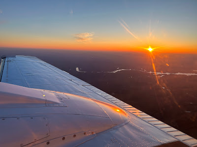
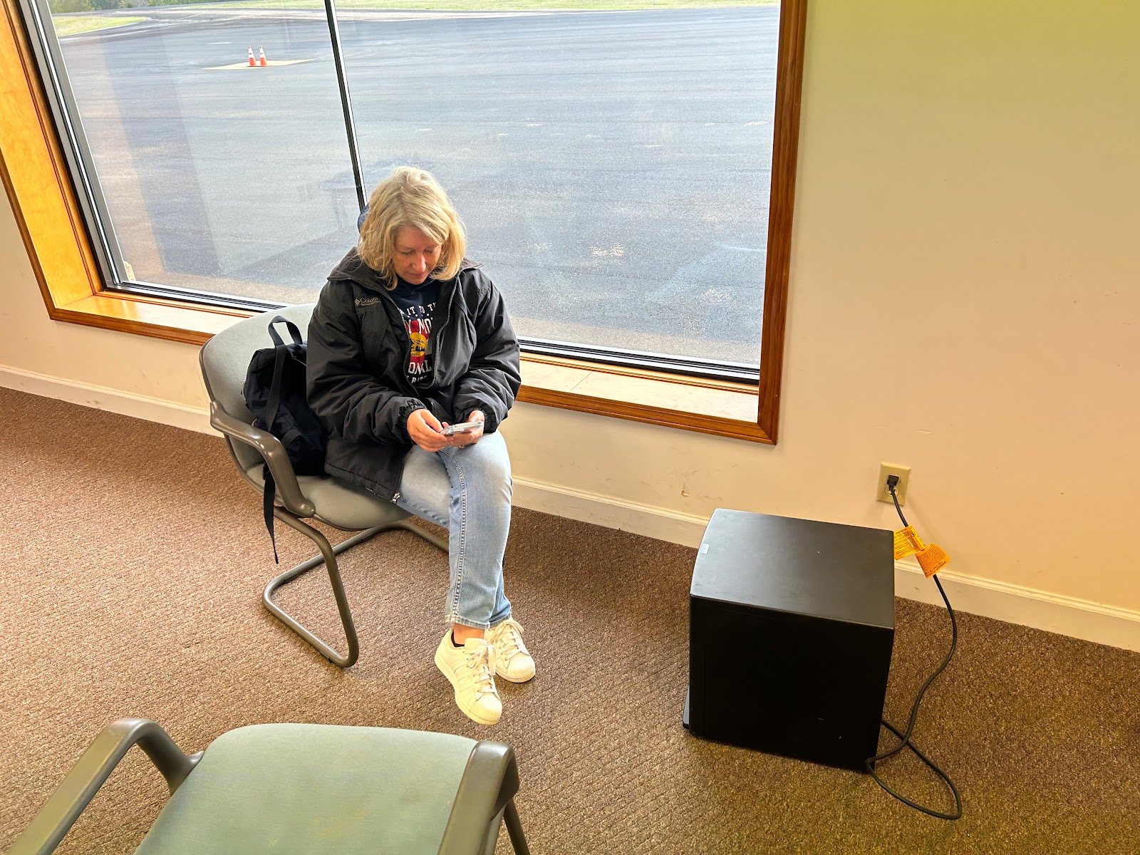
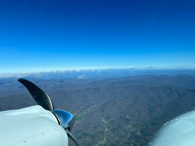
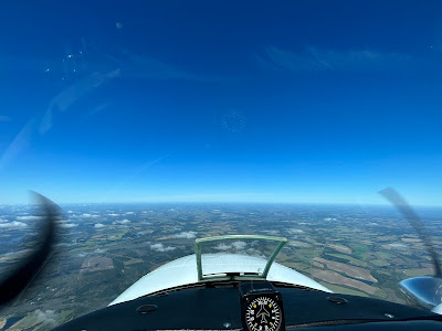
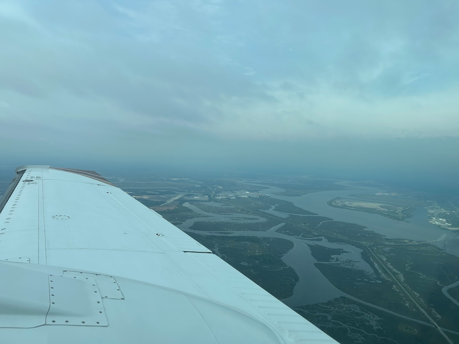
Thursday morning CC headed off to see some friends while is did some work.  We headed to the airport around noon.  I pre-flighted on a warm sunny afternoon.  We departed in clear skies and even had 2-3 knots of tailwind.  Heading home we could see the front forming off to the West.  

Other than a steep descent due to a busy controller, we had an uneventful and smooth ride.  In the end, it was a bit disappointing to have not visited 3 iconic National parks.  Yosemite was a lost cause though, the park was closed for the entire time we planned. That river dumped lots of rain and snow which made the roads impassible.  All was not lost though, I did get my heater fixed, we had a fun time and we are home safe.  In the end some good decisions.

Friday, March 17, 2023

Headwinds Suck

It was a really early morning.  Back when I worked, 6:30 was a normal time but lately that seems pretty early.  With DST in effect it was also dark and today it was cold too, 36 degrees.   We headed to the airport at 7:00 so we could arrive bright and early in Tennessee to have the heater controller checked.


Thankfully Selmer Tennessee is on central time so it gave us an extra hour.  Preflight was cold and a bit dark.  I keep many flashlights in the plane and today I looked funny wearing the headlamp but it let me see everything.  The one thing I was concerned about was frost on the plane.  Luckily it was just warm and dry enough that we were frost free.  My other worry, cold soaked engines turned out to be a non issue.  The engines were still at 40 degrees so and they started easily all was well.


The tower at Columbus GA is a bit lazier than most, they don’t open till 9 AM.  Atlanta has a frequency for clearance so after I started and checked the ATIS, programmed everything and did my final review, I gave them a call and received my clearance.  I advised the controller I needed some time and would call again for release.  Taxi out was quiet with just one other plane in the area.  A FedEx flight had just landed and was taxiing in to deliver the packages that absolutely needed to be there overnight.


After doing our run up, I gave Atlanta a call and told them In was #1 at 31 ready to depart.  I got an immediate release to depart on runway heading to 6000 with a 5 minute void time. We were rolling less than a minute later and soon checking in with Atlanta. Climbing through 4000 the headwind was 24 knots and level at 6000 it was 30, right on the nose.  It seems lately that all we get are headwinds.  


I thought about going lower, but the TAS gain for 2000 feet mostly covered the higher winds, also the plane just flies better up high.  It was cold out too. It started at 36 degrees but by mid Alabama we were down to 23.  Everything hummed along but my cylinders were running on the edge of too cold.

I like to keep them above 250 degrees F and I was right there.  As the temperature dropped I kept adding a bit more gas.  When you are running LOP (lean of peak), adding fuel makes everything run hotter.  Why do my engines run so cold?  I have an upgraded set of aftermarket baffles that were installed correctly and they created great cooling airflow.  This is great in the summer, I never worry about the engines getting too hot but is a struggle in the winter.


The flight was smooth and uneventful.  We spent most of our time over Alabama but did clip the corner of Mississippi right before entering Tennessee.  We touched down in Selmer, TN at 8:20 local and pulled up to the hangar.  Before I could get shut down the door started to open and they soon had the plane in the hangar and covers coming off.

The folks at AC services are really nice, they even provided a small heater for CC as she was not loving the cold.  I watched them for a bit and discussed the controller issue but then left them to work without interference.  CC was hungry as well as cold so we borrowed the airport car and headed to town.

The car was pretty nice by airport car standards, a Mercury Marquis.  It was sort of nostalgic, my mom always drove Ford Crown Victorias which is essentially the same car.  I had driven her cars quite a bit and I knew where everything was, even the tape player.  We drove most of the way to town to get biscuits from McDonalds.  They were tasty but not too healthy.

When I came back they were testing the corrections.  There were several small issues but taken together they kept the heater from functioning as well as it should.  After a bit more testing and showing me how to use the diagnostic mode to see what was happening, they declared the fixing done and put the parts back in the plane.  It was not too much to put back, they had opened a side panel to get at some actuators, taken out 2 seats, the spar cover and removed the nose cone.

With the plane back together, I went over each area to make sure it was back the way it should be.  Then it was off to the fuel pump to add some gas.  The gas in Selmer was a much better deal than Greenville so I bought enough so I would only need to buy the minimum at our next stop.

I have had some issue hearing Memphis center down low in that area so climbing out was surprised to hear them clearly at 1000 feet.  I was also surprised that when Memphis was expecting me.  Yes we pre filed and the controller should have a strip on you but I had just called with my call sign and did not ask for my Clearance.

He was on his game, he gave me a code and a short time later cleared us as filed.  We had endured 2 flights of terrible headwinds, this time we were going in the right direction.  As we climbed the wind swung onto our tail.  I was expecting 17 knots and at first we were a bit shy of this but we were soon scooting along at over 200 knots.

The route stays mostly in Tennessee and then slices the edge of Georgia before we entered South Carolina.  The route also takes you over the beginning of the Blue Ridge mountains.  These are short compared to the Rockies but they still command respect.  The wind at altitude was 27 knots, enough to create some strong turbulence. 


I was expecting a bumpy ride but it was initially smooth.  We did get a lot of wave action.  As the wind passes over the uneven surfaces it creates waves of updrafts and downdrafts.  As we were approaching from upwind, the first part is an updraft.  You see this because the plane pitches down to maintain altitude and the speed increase.  As you pass the surface peak, the process reverses and you have to pitch up to maintain altitude.


We were watching the nose bob up and down a good 5 degrees and were seeing speed variations of 15 or more knots.  Even with the waves it was a smooth ride.  It was a smooth ride until we cleared the mountains and started our descent.  We were now just down wind and we soon encountered light to moderate turbulence.  There was nothing to do but slow down a bit and make sure the belts were tight.


It was a really clear day and we soon could see GSP, Greenville Spartanburg Airport, while still 30+ miles out.  The controller took us the long way to final but soon enough we were cleared to land and with 11,000 feet of pavement, had no issues making the middle turn off.  On arrival our rental car was waiting for us and this time it was normal size.


The FBO charges a bit more but the rental cars are easy and has good snacks. They even started giving out ice cream. I chose the cookie sandwich.  It was quite tasty.  In the end it was a very productive day.  My heater appears to function much better, we made it to our next destination and I got ice cream.  This makes 2 days in a row, I am on a streak. 


Thursday, March 16, 2023

Wild Wild West Georgia


We had planned an early departure Monday but the storms were a bit late.  It had been a bad week across the country and the front with a line of storms was barreling down on us, Sunday it stretched across Georgia.  Yes I like using my radar but looking at the line approaching at 6:30 AM I reset my alarm and went back to sleep.


We got started 90 minutes later than planned but my passenger didn’t complain. We were supposed to be out West this week.  To be specific we should have been in Yosemite after having been to Arches and Zion last week. The reality is that the weather out West stunk.  I scrubbed the trip a few days out and will reschedule it when it's a bit nicer.


The severe weather had passed before we fired up but the weather was still snotty.  We departed into a 600 overcast.  The tops were 3200 and we were soon inching our way to Georgia. Our ground speed was the low 150s because of the strong headwinds.


Since we had planned to travel, we figured, that we should go somewhere.  My heater controller was not working quite right so I decided to combine sightseeing and maintenance but more on that tomorrow.


We had  planned to see canyons out West, so I decided to find some canyon a bit closer.   Apparently Georgia has some.  They are not quite natural though.  Poor farming practices in the 1800s created some significant erosion, in some places 150 feet of erosion.


The flight to Columbus Georgia started cloudy but soon they melted away and we had clear and sunny skies. We landed, grabbed our rental car and headed to Providence Canyon State park.  


The park was a lot busier than I expected for a Monday.  Maybe some of the kids were on spring break?  It took a bit to find a parking space but we were soon on on the trail.  I usually hike in sneakers but CC had started wearing hiking boots and I decided to join the trend.


It was a good decision, the ground was typical sand and red Georgia clay. It was also damp from those storms that delayed us.  The trail starts deceptively flat and then steepens a bi, little did I know the true definition of steep, that's Wednesdays adventure.  We first passed a bunch of derelict cars from houses that were removed decades ago.  The cars or what was left of them looked like 1950s vintage. 


We continued down and down and eventually found the trail that let you walk in the canyons and the mucky water.  I was pretty happy I brought the waterproof boots.  We noticed a few people who had worn brand new sneakers, pretty sure they were hating the trail.


We walked up the canyons.  They are quite fragile so you have to stay away from the sides.  The views were good and we enjoyed exploring the different areas.  After returning to the main trail, we hiked back up to the rim.  This part was pretty steep and I contemplated taking some breaks on the way but didn’t want to look weak so I pushed on until we made it back to the top.


The rim trail is nice too, we enjoyed the views from above and soon made it back to our car.  Speaking of our car.  I usually reserve a smaller one as there are just 2 of us.  Even though I had paid for the cheap car, Avis set us up with a beast. We had a Wagoneer.  It’s like driving a semi and it only got 19 mpg but we had plenty of room.  I think I might have asked for something smaller but they had left it at the FBO so I figured I could help destroy the planet for a day.


After the park we headed to Alabama.  Columbus is right on the border and the route I chose back to town had us driving North through Alabama.  I had a secret surprise for CC.  There is not much to do in Columbus but I did find something special.


Kadie the cow.  Kadie was originally in front of a local dairy.  After the dairy closed, Kadie soldiered on.  She has moved to a riverfront park and now looks out over the Chattahoochee River.   After strolling the riverfront, we headed to our hotel and grabbed some food.  We had to be up bright and early the next morning.

Friday, March 10, 2023

Low Country Boil


Somehow flying and food are linked.  Wednesday we went to to Georgia for BBQ.  Today our fixed base operator, Jacksonville Executive Jet Center was throwing a Low Country Boil for the airport.  It was technically a fly in as well but my plane was already there.  They are usually ahead of the game when they do these events and today was called for 11:30.  This usually mean food would be ready by 11:15.

I showed up at 11:30 and checked a few things on the plane, I was undecided on flying as we were expecting rain.  I headed over to the main hangar and found the food was a bit delayed, the wind kept blowing out the boilers.  After considering my options, I decided to take a quick flight to look at the line of approaching storms and then I would eat.  This plan had it's risks, a large crowd of hungry pilots had gathered.  The clouds kept me down at 3500 which limited my ability to image but it was good practice for approaching a terminal area and having to work lower down.


The line was about 80 miles North.  It looked pretty mean on XM but my sense was that all that yellow was not the same.  Above is the XM and below the live radar, 80 mile range tilted down  to 1 degree.  Ground clutter is evident in the 0-45 mile range.  The water does reflect much so offshore is not painting anything.  Past 50 miles you can see that along the coast the rain is much more severe but slightly left of the nose is an area of only light precip with some possible heavier areas mixed in.


Tilting up lets you isolate the rain and see that the lighter stuff is likely not that vertical as it does not paint as much at plus 4.  That heavy cell is still really strong though.  80 miles is a long way to make a tactical decision but it is starting to build a picture.  Now it takes 28 minutes to get there so a lot can change before you get to the line but right now there does appear to be a pretty good gap right down that green line on the XM picture.


One thing I dislike about the Garmin display is that it does not display the radar tilt or let you change it when you are using the map overlay.  Here is the radar page showing the same picture.


I chose to limit my interactions to the 30 mile range.  While the line did not have a lot of strong storms, and they weren't heading for me, I didn't want any surprises.  The big picture at 30-40 miles.


You can clearly see that one red cell.  I used the vertical mode to get a closer look and initially was surprised.  Not with the cell but with the picture.  When you do a vertical profile you usually see the ground to the horizon and then any storm shows up as vertical blobs.  The storm was there but what happened to the ground.  After a few sweeps with me thinking something was wrong with the radar, the lightbulb went off.  I was looking 43 degrees right.  I was on the coast and there was only water between me and the cell, hence no ground return.


Heading over land a bit and reshooting the picture, mother earth reappeared.  Very reassuring.


It was time to head home. So I took one more look paralleling the line


XM above, live radar below.  I am tilted to 0 degrees and 0-30 miles is all clutter.  That one red cell 45 degrees off the nose may be a city but you can clearly see the line of rain extending out to 100 miles.  At this tilt It's hard to really see what is strong but the large areas of yellow would worry me.  They align with the red areas at 60-80 miles.  I would expect them to be better defined as I got closer and likely areas to avoid.


Just because something looks benign 80 miles out does not mean it really is,  at 3500 my ability to really discern past 40 miles is limited.  As I approach these may become strong returns.  Today was also a day that illustrated why radar is so useful.  In some situations your eyes are your best tool.   Today was hazy It was impossible to see the difference between some light rain and a wing shedding cell.


When I got back the boil was ready and I enjoyed 2 plates full before wiping the plane down and heading home.  A great day when you have boil and flying.