Friday, October 18, 2024

Making Plans

Looking back on our travels, I see I write a lot about the flying but that's just one part of the logistics.  It's an important part but if you arrive somewhere and can't get around or have no place to sleep, it's not much of a vacation.  When I start planning a trip I usually start with what we want to see.  Usually I have some desitination or main attraction in mind.  
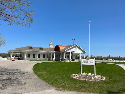
For example, when we went to Michigain I wanted to see Mackinac Island and the Shipwreck museum.  Once I know where I want to go, I need to consider three things.  Where to park the plane, where park us and how we are getting around.   It then becomes a balancing act trying to find the best options.  In general for most locations we need a rental car.  This seems to drive our decisions a lot more than you would think.

There are some locations where we can Uber, for example St. Louis, much of what we wanted to see was near our hotel so Uber was perfect. We actually rented a car one day but it was literally a morning pick up and same day drop off.  Having a car would have been more of a bother and would cost a lot more.  This is the rare case, on our latest trip we needed a car in all but our first stop and that was because it was really just intended as an overnight without sightseeing.

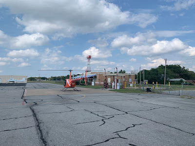
The easiest way to get a car is to land at an airport that has airline service, almost all of them have some car rental option.  In most cases the car rental company will drop the car at the FBO (fixed based operator) if you are in their loyalty program which makes the entire process easy.  Rentals at these airports tend to be the cheapest too.  The next best option is that some local rental company services the FBO and will drop off a car.  Sometimes you go through the company and sometimes the FBO has a negotiated rate but typically this will cost a bit more.  That said, being at a more convienient smaller airport often makes it a good trade off.

We did this in Tacoma for example, Enterprise was the supplier but I made the reservation through the FBO.  It was a bit more expensive but easy.  In some locations you have to get creative.  In Nebraska a local ford dealer dropped a car for us.  Pricing was good and it wasn't a terrible car but I initially couldn't find the keys.  The FBO didn't have them and I ended up calling the dealer.  They just left them above the visor.  I guess this big city kid isn't used to cars with the keys left inside.
Second consideration is the plane parking.  Big airports come with big costs sometimes and can often be more congested to get in and out.  Gas pricing can be quite a bit different from airport to airport.  On our last trip we had a spread in price of  $2.75 per gallon and with us buying several hundred gallons over the trip, price starts to matter.  Luckily with the Baron I have big tanks and it is preferrable to leave it partially fueled as we have better performance a bit lighter.

What I usually end up caring about is parking fees, ramp fees, junk fees and the minimum fuel purchase required to waive the fees.  Some places will waive all the fees and even a night of parking if you buy a minimum, typiclly 30-40 gallons with the Baron.  So if fuel is $2 more than my next stop and I need to buy 30 gallons, I hope to avoid $60 in costs to justify it.

On our latest trip we only paid parking in 3 of the 8 overnights, parking varied between $15 and $30 a night.  At the expensive place I got one night waived as well as all the fees which were around $80 so the overpriced fuel worked out.

Hotels are the last consideration.  Typically this relates to how close we will stay to what we want to see.  For example, we could have stayed closer to Yellowstone than the 1:20 drive we chose but the accomodations closer were much more rustic.  I don't mind basic but I am done with rustic charm, give me a clean room with a hot shower and decent bed and I am happy.

In the end ground logistics can be a huge driver of where we land.  In Wyoming I could not find any rental cars going into Laramie so we chose to land in Cheyenne and drive 40 minutes to make the logistics work.  It was not all a loss as one of the places we wanted to visit was between the two so we picked it up on the drive back.  Typically it is a trade off balancing the three factors.

On our Oregon stop I looked at Medford and Klamath falls.  The FBO was cheaper at Klamath but cars and hotels were a lot more and Medford, while slightly farther to Crater lake, had more other things we wanted to see closer.  Sometimes you have multiple good options but often one of the factors will drive your decison and you make everything work.
This is just a glimpse at what goes into planning some of our bigger trips.  I can easily spend more time on trip logistics than flight planning but the time spent translates into a better travel experience.  It's really nice when you land, you are expected, the car is there and the hotel has your room.  Not having to hastle with logistics enroute is the reward for planning.

Monday, October 14, 2024

It took 7 years????

It took us 7 years to visit 48 states.  Back in early 2017 we had just come home from an overseas assignment.  I had shut down my travel blog and bought an F33A Bonanza.  My daughter told me I should start blogging again and I asked what would I blog about.  She asked if I had visited every state and I said, no.  Thus was born the beginning of an idea.  Beechtales first post said that "It will likely be a mixture of flight reports, fun pictures, comments on destinations visited and general information about my plane and me.".

It wasn't until 2 months later when I started to commit to the idea and after landing in Georgia I marked it off the list.  I had been ruminating about what a 48 state challenge should be for me.  I had just picked the plane up from California and flown it home, were those states already done?  In the end I decided to start fresh.  I also needed to decide the purpose of the whole thing.  I made a list of all the states and then started picking something from the state I wanted to see.  Some states had many options and it was a hard choice to come up with just one.  Some states, well not so much, they did not really offer anything new I wanted to see.  

With all this in mind, I decided the criteria would be to land the plane in the state.  We would sightsee most but the focus would be on trips we wanted to make to places we wanted to see.  In the end we ended up with  7 technical stops.  Two of the states we had spent a good amount of time in previously so in reality our technical stops were Kansas, Mississippi, Indiana, Massachusetts and Rhode Island.    We did overnight in Mississippi and I have been through it many times so maybe that can come off the list too.

We completed 21 states with the Bonanza before I upgraded to the Baron for the last 27.  Along the way we landed in 10 of the original with the Baron.  We actually hit some states multiple times for multiple reasons but for the count I am only considering the primary visit.

It took us 16 different trips,  about 190 hours of flying and over 28,000 nautical miles to complete the quest.  Definitely not the most efficient path.  Just clicking a random path between the states and you can cover all 48 in under 7000 miles.  I'm sure there is a more optimum path, heck we flew 5100+ miles to see 9 states.  So efficiency was not a driver, in fact for all the flight time we could have flown around the world quicker.

Nine of our trips only added one state to our tally, for example I had to be out in Oklahoma city for a class.  We had already landed in Oklahoma and most of the states on the way.  We picked up Arkansas on this flight but it was not an efficient way to get a state.

We also did 6 bigger trips where we snagged 4 or more states, our record was 9 on one trip.  Some of the flying was routine, droning along but we had the occasional weather to deal with though few instrument approaches.  Part of our luck was self made, we did adjust trips a bit to pick our weather and in some cases when the weather went really stinky bad, we moved trips.

From a flying perspective some of the most memorable sites were flybys of Niagara Falls, The Arch, The Rockies, The Grand Canyon and the Hudson Corridor.   We also did a good job seeing some of the iconic and lesser known national parks.  CC and I are not outdoorsy people but we enjoy the outdoors in moderation.  We like to hike easy and some moderate trails but then enjoy sleeping on clean sheets after a hot shower and a warm meal. 

From a flying perspective, it is a lot different flying 900+ mile distances than the more typicall sub 300 mile visit to the Grandparents.  The longer legs mean more weather, more different terrain and more planning.  I stay instrument current and proficient and can say there were no flights where I was concerned or felt over my head.  Again, I cheated, I left a day early or late sometimes so I chose my weather.  

Should we have gotten done quicker, maybe, but we were in no rush.  I am glad we did it though, we often go back to some of the same places which is fine, we like them but it's good to push yourself to see new stuff.


Tuesday, October 8, 2024

End of the Quest! (#1 Louisiana)

It was time to head home.  We wanted to get an early start and I had set my alarm for 5:45 AM.  I still woke up before it went off and after the morning routine we were on our way.  Top off the rental car, don’t forget to leave the keys, load the plane, preflight and yell CLEAR.

We lucked out on the weather.  That potential Hurricane had become the deadly Hurricane Helene which slammed into the Florida Big Bend late Thursday.  Flying towards a CAT 4 hurricane is usually not advisable but in this case Helene was really moving and by the time we left at 7AM mountain time, She had pushed through.  Not only would our path be clear but we had the potential for tailwinds on the backside.

The departure from Canyonlands was another high altitude takeoff.  The field is 4,579’ and even with the cool morning temperatures the Density Altitude was around 5,300’.  This was not the worst we faced but we were a bit heavier than Truckie.  Also the land around the airport has a gentle slope up in all directions so you need to climb a bit in an emergency.  The book said we had 250 fpm at 100 knots.  The book can be a bit aspirational so I figured in less.  I had an emergency plan and briefed the departure, thankfully, I did not have to use it.

The ramp was still sorta dark when we arrived and used my flashlight for preflight.  By the time we fired up it was about 20 minutes til sunrise and takeoff was about 12 minutes before sunrise.  I had waited for the light as I wanted to be able to see the terrain.  Acceleration down the runway was sluggish as expected but everything worked and we were soon climbing strongly to 9,500’.

The Eastern sky was bright and then like magic the sun started peaking over the horizon.  It is really amazing how fast it rises and we went from enjoying the colors to moving the visors to block the light.  It is always fastest to go direct but there are 14,000’ mountains in the way so we headed down to the Durango, CO area.  We had previously flown home from Durango.  Today’s flight would be about 140 miles longer clocking in at 1,555 miles.  

Once passing Durango, we continued over Santa Fe and then once clear of the mountains, direct Hereford Texas.   We have stopped here before, cheap gas, good runway and good facilities.  It also smells like cow as it is surrounded by feedlots.  We touched down after 2.5 hours and 464 miles.  Usually they help you fuel but today the place was deserted.  They also usually have candy but again nothing today.  The gas was still cheap and the bathrooms clean so no complaint.

We had gone VFR with flight following in the mountains but leaving Hereford we picked up our IFR clearance and settled in at 9000.  Our next leg would take us to Minden, LA.  Unlike the last flight that required lots of study for terrain and fuel planning to minimize weight, this was relatively straightforward.  Hereford is only 3,800’ but with the higher temperatures the Density altitude was a bit higher than Canyonlands.  The big difference was that this part of Texas is pretty flat.  In an emergency, we also could just fly straight ahead and had several places to land including a long runway at Amarillo.

We checked in with Amarillo departure, were immediately cleared as filed and leveled at 9,000’ for the next 471 mile hop.  Minden was a bit of an odd choice as it was too short for us to easily make it a 3 hop flight and too far to break it into 4 equal hops.  Odd or not we had a reason, we had landed in 47 of the 48 states and we still needed to pick up Louisiana.  Yes we sightseed most of the stops but we had been to Louisiana many times and felt we had seen the state. For the reasons above it never seems to be a fuel stop so somehow it had been left till last.

The first flight we had a combination of light head/tail winds.  This flight we had a bit more head than tail.  We were still not in the zone being influenced by the hurricane but that would come soon.  We arrived at Minden after 2.6 hours and were shocked that no crowds had gathered to celebrate the completion of the 48 state quest.  There was a guy in the very nice FBO at the desk but he did not seem aware of the momentous occasion that had just occurred.

Regardless, I grabbed a selfie, topped off with cheap gas and then we hopped back in for a quick flight to Meridian, MS.  Another uneventful departure and we were again at 9,000’ with less than an hour till we stopped for a snack.  Leaving Minden we started to feel the effects of Helene.  The counterclockwise circulation started to give us a boost.  The push started small but soon we were cruising at 215 knots or more.

We had started full of gas so fuel was not an issue and as we approached top of descent, the computers were saying we would be home in 2.2 hours.  We had a quick discussion and decided to skip the stop.  ATC updated our destination and cleared us home via direct.  The winds kept getting better and at one point we hit 230 knots ground speed.  It did not last all the way home but we were above 210 most of the way.  


Planning the flight weeks ago, I had figured closer to 3.7 hours but with the tailwind we cruised home in 3.1, pretty respectable for 620 miles.  This was a 207 knot average which is dragged down by the climb and our departure/arrival maneuvering.  

We were soon talking to Jacksonville approach and set up for the visual to 23.  Winds were strong and gusty but I focused and had a nice touchdown.  After shutting down, we unloaded our junk, pushed the very dirty plane into the hangar and grabbed a celebratory soda from the fridge.  It was mostly cold as there had been a power outage from the storm.  The fridge had a puddle from the defrost but the celebratory soda tasted great even if it wasn’t ice cold. 

It had been a long day and I was a bit sore and tired from sitting so long but also happy to have successfully completed another adventure and to have finished our quest to land a Beechcraft in all of the lower 48 states.


Arches and Canyons

We had come to Moab for Arches National Park.  Arches is a very popular park and they instituted a timed entry system to manage the crowds.  I forgot to get a slot month out and when I went online the earliest slot available was 11AM.  Luckily there is a second chance for people like me that forget to get a slot.  They only give out about 60% of the slots initially and the night before they open up the rest.  We were able to update our reservation to 9 AM.  

The park also allows open entry between 4 PM and 7 AM.  We took advantage last night and went in at sunset.  Our hotel is only a mile from the park so it is an easy drive.  The colors of the sunset were well worth the drive and after a drive we stopped at balanced rock.  We made the short hike at twilight and then sat out and chatted with other travelers as the skies darkened and the stars emerged.

We started our official park day in the morning.  I was a bit skeptical of the entry slot program and was worried that the park would be too crowded but the program works.  Parking is limited throughout the park but we were able to stop everywhere we wanted and always found a space.  We entered at  9:15 to avoid the punctual people and took only about 2 minutes to get through the gate.  Then we went sightseeing.  Park Avenue is an amazing canyon with views of Courthouse Towers.  We stopped at both for the views.

We skipped balanced rock and headed out to Double Arch, Window Arches and Turret Arch.  These were great, for less than 2 miles of hiking you get 5 arches plus lots of scenic views.  Our timing was lucky again.  The people around the arches ebbs and flows and we happened to get to them with few other people around.

We also picked up the Garden of Eden.  Not sure why it is so named but it was very picturesque and we made an easy climb through some nice rock formations.  Moab was supposed to be hot, upper 80s but the temps were much cooler in the morning so it was quite refreshing.

We then headed to the back of the park to see some more arches.  The hikes here were a bit harder and we opted for the easier Tunnel Arch and Pine tree Arch.  This area was more crowded but was not mobbed, maybe the system works.  Also without crazy mobs, it seemed the people were more relaxed.  We met and chatted with several people along the way.

On the park's back side we took two more short hikes to Skyline Arch and Sand Dune Arch.  Sand Dune Arch requires you to walk through a narrow passage and then trudge through fine silty sand to the arch.  It was much harder to hike on the sand but the arch was nice and the shade was refreshing.

It was afternoon by now and it was getting hotter.  We were working through our water so when we got to the Delicate Arches we chose to take the short observation walk rather than the multi mile climb to see them up close.  We had hit all the trails we had planned and a bit more so after about 5 hours we headed out to get some tall sodas and food.


We waited for the temperatures to start abating and headed back into the park for a few more hours.  We picked up the hike from Courthouse Towers through Park Avenue.  We did about 75% of it stopping when it started its more aggressive climb.  We then went back to Balanced Rock to get the view in a better light.  It was pretty empty and we climbed the base to watch the sun set.  It was a great perch with a nice breeze and we watched the shadows grow along the desert floor.

As the sun dipped below the horizon, the temperatures dropped and we headed back to let the skies darken.   We were not done yet though, Arches has good dark skies, so we headed back in one last time and parked by Park Avenue.  After a few minutes our eyes adjusted and we were rewarded with the stars.  Not the few bright ones we see at home, billions upon billions of them.  We could even see the milky way.

We made a great decision and slept in the next day.  Our goal was Canyonlands National park.  The park was just 30 minutes down the road and we made it to the gate around 9 AM.  Once again the park was not too crowded and while spaces were not always plentiful, we did not have to spend much time finding one.  This park has some nice short hikes and many brutal long ones.  Yesterday we walked around 8 miles.  Today we were less ambitious.

Ironically our first stop was Mesa Arch.  Yes, yesterday was Arches, today is canyons, yet we went to an arch.  Mesa Arch is small in comparison to the others but it frames a view of the canyons that takes your breath away.  Pictures were hard when we arrived because there were quite a few visitors but as we were hanging out, they headed off and we had some great quiet time with the views.

The rest of the park is all about the Canyons and a bit about Buttes.  I've said it before, I like big buttes.  We went from stop to stop enjoying overlooks and making a few short hikes.  We spent about 4 hours in the park.  The temperatures were initially cool but the high was 88 and as the afternoon progressed we could feel the heat.

In the shade and with a breeze it was actually quite nice but in the sun it was warm.  Canyonlands is a great park but since it is right by Arches, it seems to get less love.  I must admit, even though I don’t have an Instagram account or use the App, we did some very Instagramy pictures.  If I was only a lot cooler, I could be an influencer.  I am guessing I am in the wrong demographic for that line of work though.

Our last sightseeing day on our trip, we planned to take it easy.  More driving, less hiking.  There is an iconic loop road we planned to take but the loop was interrupted.  This was the third loop road that was closed on our trip.  Once again we had to drive in and out but it was a spectacular drive.  We started by following the Colorado river and then headed up into the mountains.

The views were astonishing.  Tall canyon walls, flowing water, blue skies.  We then turned off the river and headed through a canyon.  The greenery surrounding the river melted away to expose the red soil and striated canyon walls.  As we progressed further and climbed higher into the mountains the terrain suddenly changed to a more forested mountain landscape.  

We arrive at a small pullout, Bull Canyon Overlook.  The literature said we had a short trail, so we booted up but it was much shorter than I thought.  A few feet from the parking lot we came upon our first prize.  Locked in the rock were dinosaur footprints.  A three toed beast.  


After admiring the talon prints, we received our second prize.  There was an amazing view of the canyon.  The drop offs were sheer and terrifying so we stayed back from the edge.  We followed a short path along the edge, for more spectacular sights.  We also had great views of the beginnings of fall.  The colors were starting to change on the mountain.  We were over 8,000 in elevation and had a close view of the mountain peak.

On the way down we stopped along the way to snap pictures of cool rock formations and enjoy the scenery.  We eventually came back to where we started just a mile from the hotel and headed South through Moab.  We had one last arch to see.  Wilson Arch was 28 miles South and can be seen from the roadside pull out.

The trail up is a bit rough and the boots came in handy here.  I did not go all the way but did ascend to just before the arch.  The views were striking and it capped off our Utah adventure.  The temperature was rising again so we decided to take it easy.  I did want to make sure the plane was ready for our flights home so we dropped by the airport to clean the windows, check the fuel and oil and get everything set up.  We also loaded all the junk we no longer needed so we had less to do in the morning.

We had one more hike in us and as the sun was starting to set, we headed onto the Moab Canyon Pathway to walk over the Colorado river.  The flow seemed anemic and I thought that all those people down in Southern California are getting mighty thirsty.  Regardless, it was a nice stroll and the bridge over the river was nice.  Time to pack up and file some flight plans, we need to be in the air early in the morning.  The Hurricane that we were watching, became a major and is slamming into the bend of Florida but should be out of our way by the time we arrive.