We left Medford headed for Truckee California bright and early. We were less than a mile from the plane so the commute was easy. The weather was great too, just a little smoke but our visibility at 9,500' was excellent. We have enjoyed some pretty good weather and only had to shoot one instrument approach. Our luck may be turning though. We have been watching the tropics and though we are 6 days from returning, the Gulf of Mexico may have an unpleasant surprise.
Nothing today but many of the models forecast a strong low with possible tropical weather at the end of the week. None of the models agree so for now we are closely watching to see if we need to make any modifications to our timing. Today though, it was all about blue skies.
Our Medford departure was to the North which was the wrong way but I was happy with it. There are tall mountains South of Medford and this allowed us to gain more altitude before we approached the higher terrain. We went VFR with flight following because the MEAs were pretty high and I wanted to enjoy the views.
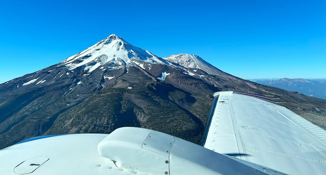
About 25 minutes from Medford was Mount Shasta. We got exceptional views and by staying upwind the ride was mostly smooth with a bit of light turbulence. Flying around the mountains, it is often hard to judge your clearance but our terrain awareness feature highlights any issues. In the mountains I keep the page up on one of the screens, sort of like watching the weather in the Southeast.
The arrival into Truckee is interesting. Truckee is at 5,900’ and surrounded by mountains. They are also very noise sensitive. They publish extensive procedures and while it is always voluntary, I like to be a good neighbor. I had studied the local procedures so I knew to begin our approach over the reservoir and followed the highway inbound. They were using the shorter runway and given the conditions I requested runway 29 which is 7,100’ long. Tower obliged and had us make a high overhead approach.
We had a nice arrival and ground control explained where to park. It is a royal pain to push the Baron around so I was keen to find a space where I could pull in straight without having to push the plane around, basically princess parking. We were lucky, the end row had the first space open and we were soon parked and I had us tied down. We went to the office and ordered gas and after that got our rental car. Enterprise is not on the airport but it is only about 300 feet from the door.
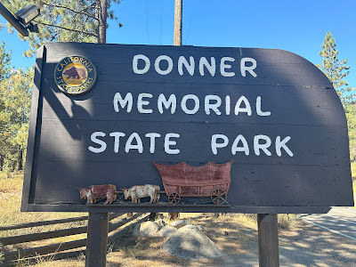
By the time we had the car we drove back to the plane and watched the fueling. We paid for the gas and we were ready to roll. We started at the Donner Party Memorial. I’m not sure how to feel about a memorial to a group that made a lot of bad decisions and ultimately ate half their party. My opinion is not shared as they seem to be locally popular as many things are named Donner. Just to be clear I steered clear of any Doner Kabobs while there....
We grabbed some coffee and then took a drive by the lake. When we arrived we had not yet seen Lake Tahoe. I thought it would be visible but the view is blocked by a bigmountain. This geography would figure prominently in our departure but today it was just blocking the view. We did not do too much at the lake as that was our Sunday activity. Finishing our lake views, we headed for Reno Nevada. Yes this is the California stop and we won’t land in Nevada till Monday but we will sightsee both.
The trip to Reno is quick, only about 35 minutes. We of course saw the famous sign, cruised the strip and walked through a casino. The casino was dingy and smokey, it was a sort of sad looking one. We also did the riverwalk. The Truckee river flows through town and they have done a nice job making it an attraction. People were swimming but I tested the water and it was too chilly for me. There were all sorts of people enjoying the day including one guy who seemed to be meditating in the river.
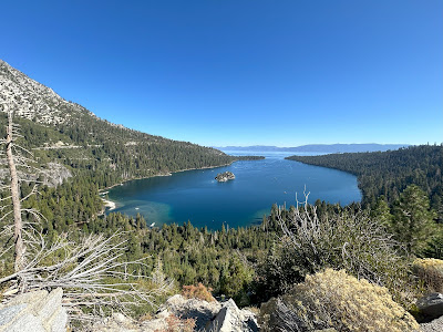
Our first stop was Emerald Cove. Parking was a nightmare but after some wandering we landed a perfect space with great views. We did a bit of hiking to see a small waterfall and then headed off to the Nevada side. Yes the lake is split, about two thirds California and one third Nevada. This means on one side gas is cheaper and you can gamble.
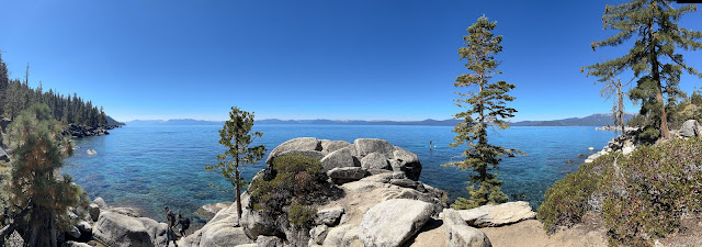
We continued around the lake and eventually made our way to Secret Cove and Chimney Beach. Parking was again an issue but we found a roadside space and started our hike. It was pretty steep and all down hill. The beach seems to be so named because there remains a fireplace and chimney from an old cabin. The cabin is no more.
The views were quite good and we watched people go into the frigid water and even jump from the rocks. Heading back we had to walk up the very steep trail in the thin air. The lake surface is 6,225 feet and we had to go up a few hundred feet. After much huffing, puffing and higher than normal heart rate, we made it back to the car. We did some more sightseeing before heading off for food and rest.
I see why people like the California mountains. Blue skies, nice temperatures, mountains, trees, it has it all. That said, I can’t imagine it in the winter with feet of snow, chains required and the bitter cold. Tonight I will be reviewing the departure plan. Truckee is at 5,900' feet and even at our light weight with less than full fuel, we will have limited single engine performance. There is also a lot of terrain and noise sensitive areas to avoid so until we gain some altitude any issues will be critical and we need to be prepared.


No comments:
Post a Comment