Wednesday, March 8, 2023

A blustery day

I had told my daughter that I would take her for BBQ today.  When I planned the flight it was supposed to be a nice sunny day.  It was a sunny day but rather blustery.  Winnie the Pooh fans would know that it was Windsday.  I woke up to howling which should have been my first clue.  The second was that all the trees seemed to be dancing.

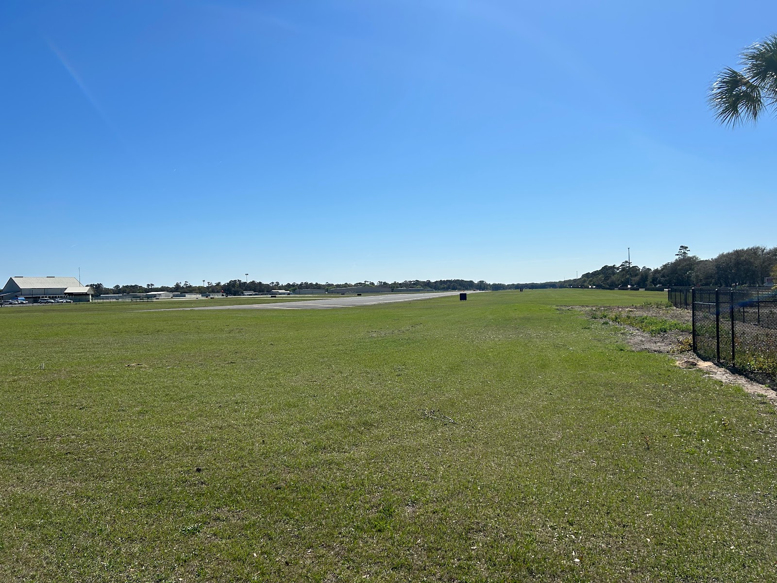
Winds were 18 gusting 29 but dropping during the day.  They were also right down the runway so while not perfect it wasn't bad.  The trip is pretty short in the Baron.  49 miles at full speed is about 16 minutes but we pulled the power back and enjoyed the scenery.  That makes it a 20 minute ride, plus a 5 minute walk.

We had flown just off the coast which provided a surprisingly smooth ride.   I was a bit concerned that it might be busy as Saint Simons has a big conference starting Thursday.  They even have a temporary control tower planned for the next 4 days.  Luckily it was still quiet and we were soon parked and heading for BBQ.

Southern Soul is a favorite but they have changed over the years.  It used to be a hidden gem and while the food is still good, they have pared down the menu and expanded the seating.  It has lost a bit of its charm though not the delicious flavor and who can argue with BBQ at the end of the runway.

The ramp at Saint Simons usually has some impressive Jets and today was no exception.  We were parked just down from a Gulfstream.  Yes that would be a nice ride to have but it burned more fuel waiting on the passengers to load than we did all day.

The winds had reduced a bit in the afternoon and after eating too much we headed home with the some leftovers and soon had the plane safely in the hangar.  

Tuesday, January 31, 2023

Foggy Nights

Monday I went for a night flight.  The weather at home was good, 4000 broken but off to the Northwest, the clouds were lower.  I filed an IFR plan to Homerville, GA and back home.  Just South of JAX I hit a cloud wall which is what I wanted, I have been building night experience and was expanding to night IFR.  I have very little actual IFR at night and this was some good practice weather.

Arriving in the Homerville area I set up for the GPS 32.  AWOS was calling for 3500 Overcast and though I turned up the runway lights, I could not see the field.  The reason was soon apparent, there was a lower layer between me and the field.  At the FAF, I could see the beacon winking at me through the clouds but no runway.  Minimums are 491' and the field is at 187' so you an go as low as 300 feet above ground level.  Given the conditions I set my minimums at 600 to give me some extra room and started down.  I was solid for most of the way but right at 600, poof the clouds parted and the runway was right ahead.

I executed the missed and I guess the AWOS was right as it was clear over the airport.  A valuable reminder that the weather over the airport is not always what you may get on the approach.


Tonight I went out again for some more practice.  There had been sea fog most of the day at the beach but the forecast was for good weather until after midnight.  As I was holding for departure, the chatter on the radio was the approaching fog.  Mayport was 400 and Fernandina was 300.  I launched but decided to stay close to home.  I spent a nice hour watching the fog slowly roll in.

It never quite got to the airport and a few hours later it still hasn't.  It did get within about a mile though so not wanting to risk having to divert I headed in at the end of my hour.  There was a cool breeze as I pushed the plane into the hangar but it was decidedly warmer at home.  Interesting weather and great training.

Wednesday, January 4, 2023

A line I wouldn't cross

I had planned to just drop by the plane to do some cleaning but when I arrived I took another look at the weather and couldn't resist the training opportunity.  Today was a perfect day to shoot approaches and practice with the radar.  There was a line of storms moving in and as I sat in the hangar it was about 130 miles out.

I was a bit low on gas, only 3 hours, so I decided to start with a practice approach and top off.  I headed to 28J and shot the GPS 27 through some bumpy clouds breaking out at 1600 for an easy arrival.  After topping off, I picked up my clearance on the ground and was quickly released.  My plan was to fly to OTK (Valdosta VOR) and then turn around and come home.  By the time I was back in the air, the storms had moved much closer to OTK so I wouldn't have to go as far to practice with the radar.

I have been very happy with the addition of onboard radar to my bag of tools and on several trips it has really made a difference and allowed us to travel through areas of convective weather safely.  Today was not one of those days.  Even though radar gives you the real time information to safely avoid severe weather, today there was no safe path to find.  It did provide some good practice though.


This was a significant line and was actually easy to image at 100 miles.  The physical horizon was 95 miles out at my 8000 foot altitude.  I started with a 0 tilt and you can see the ground clutter as the beam reflects back until around 75 miles where the angle of incidence is not great enough to reflect back.


I prefer a 2 degree up tilt at this range.  You pick up less clutter but the core of your beam is still hitting the storms at the critical levels.


As I got closer it was clear that I was not going to go to Valdosta as the storms had moved quite a bit and I was seeing some small cells forming in front to the line.  It was looking mighty dark out the window.


I requested a re-route and was cleared direct Taylors which was a safer heading.  You can see the smaller storms starting to form to the left of my old course.


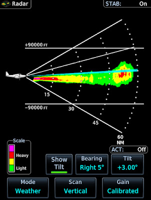
Just before I got to Taylors I did a bit of vertical profiling.  I had that big cell about 60 miles out


Here is the vertical shot.  I was at 7k and my beam was angled up 3 degrees so doing some math, the blue line intersects the storm at around 25k,  The tops are painting around 35k.


Also notice how the ground clutter is pretty symmetrical but the storm is clearly vertical.  Here it is again about 7 miles closer.  Notice that since I am not heading directly at the storm I am now pointing at a different slice of sky and it has a slightly different structure.


After making the turn at Taylors, I went from dark to blue skies.  Home was calling for 1800 overcast so I  had to be sequenced for the ILS 32, circle to 23.  The controller had held me high and then given me a steep descent.  I also had about 20 knots of tailwind up high so when he requested that I drop my groundspeed to 170 and then 150 I replied with unable.  I told him I could as soon as I was level.  
 

He gave me a vector and once I was down top 3000 I slowed to 149.  The approach was fun, I turned final with the airport in view but as I approached the FAF I entered a big puffy cloud so technically it counted towards currency. The approach was easy but the real trick was the landing 20+ knots, of gusty  variable winds with lots of turbulence on final.  Usually I could easily make the 1500 turn off with a headwind but today I just let her roll and coasted off at 2500 feet.  

As I write this the storms are only 30 mile away and we have tornado warnings.  The storms have moved 100 miles in 4 hours.  This was one line I was not going to cross.  


Monday, December 12, 2022

Thin Soup

Coming out of annual I always feel rusty as it's the longest time I go each year without flying.  This year was no exception so I have been training in anticipation of next year's travel.  I started by regaining night currency.  Then to celebrate I took CC for a nice night flight.  We started the engines 30 minutes after sunset which is official night.  It had been a clear afternoon but the forecast was for low clouds.  Departing we had clear skies but as we headed North, there was a definite undercast.


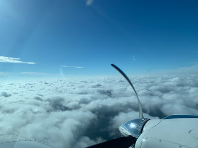
Even though we departed at official nighttime, when you climb you still get the faint glow of twilight.  The phone takes a slow picture and makes it look a lot brighter than it appears to our eyes.  You can see the clouds in the picture above.  Fernandina was still reporting VFR but looking down if was overcast.  We headed South and took a look at the Saint Augustine lights before heading home.  Descending through 800' we could see a noticeable haze as the layer was starting to develop.


Today I headed back to the plane and was not sure what I would do, the weather had been fickle from blue skies to overcast.  I checked the latest METARs or Meteorological Terminal Air Reports, a fancy way of saying the latest weather observation and Saint Augustine still had clouds even though it was sunny in Jacksonville.  I decided to head out for some instrument practice.  The best practice is in actual conditions so I filed to Saint Augustine and headed down.  In this case my worry was that the weather was improving and that by the time I got there I would not have actual Instrument Meteorological conditions.


As it turned out, it stayed just cloudy enough and I shot the GPS 31.  The controller turned me on final with plenty of room but high.  I was actually above the glideslope.  I was doing this approach with the autopilot.  Some systems can't handle a capture from above but the KFC-200 does not care.  Rolling onto final I dropped the gear, reduced power and commanded pitch down.  The the glideslope centered, the AP locked and I reset approach power.  It's important to know how your AP will handle captures from above as you will eventually be put in this situation.


After chatting a bit with local pilots, I headed home.  The METARs once again indicated good weather but METARs are history.  I had a feeling things were deteriorating so even though I had sunny skies down South, I filed a flight plan that I could pick up in the air if needed.  Departing Saint Augustine, I headed over the coast and climbed in blue skies to 4500.  What I saw to my West was not the promised broken to scattered clouds but rather a solid layer stretching as far as I could see.  So much for METARs, they were history.


I enjoyed floating over the fluffy clouds for a bit but then it was time to head home.  Jacksonville approach had my clearance and I was soon tracking direct to JEVAG to shoot the the ILS 32 circle to 5.  The controller gave me a tight turn which kept me ahead of two slower aircraft and I was soon on final with needles centered.  Since the last approach was on AP, I hand flew this one.  The wind was only 7 knots so I asked for a straight in and tower worked it out.  This reduced my taxi time and added to the training experience.

The FAA requires pilots to study the current weather and forecasts but that can lull you into a false sense of security.  The current observations are not current by the time you read them and the forecasts while generally good can be off by quite a bit.  Study the weather but always assume it can be worse than forecast and have a backup plan.  Today the worse than expected weather meant I got some good training opportunities which I had not expected.

Monday, November 14, 2022

Out of annual

 Annual took a lot longer than I had hoped.  The plane was in good shape but right after I went in a hurricane came which lost us a week and then the shop lost some of their employees which really slowed them down.  The inspection stretched out  some extra weeks but I  got here back November 3rd.


I did need some work done on my heater which took some time and my strobes were broken so I opted to upgrade to LED ones.  The new ones are by the same company but installation takes some time as new mounting brackets have to be fabricated and many other details attended to so they start blinking when I flip the switch.

Of course after getting the plane back we had another hurricane but I have gotten a few flights in.  Tonight after having marginal weather most of the day, the skies cleared and I headed out to regain my night currency.

I started up 30 minutes after sunset and then headed out to watch the last glow on the horizon.  I planned my first landing for a few minutes more than an hour after sunset.  They don't count before then.  My first landing was a bit flat but smooth and my next was good but I floated a bit.  I was using Cecil field as the runway is >12,000 feet so plenty of room for full stop and go landings.


I left Cecil and took the long way home to enjoy the night.  My final landing was right on,  I coasted down to the turnoff by my hangar and put the plane away.  Good to have her back and to be night current again.  I'm instrument current but my next goal it some refresher training in this area to stay sharp.

Saturday, October 8, 2022

Hot Dogs

I flew the plane to the mechanic for it's annual inspection on September 26.  I was a bit nervous with Ian coming but being on the other side of the state, it looked like we would fare well.  That's all history now and though the storm did slow down progress a bit as the shop closed for 3 days, we are back on track and I am looking forward to having a plane again.

I have a tradition of holding an event at the hangar when the plane is gone.  I had planned for last Saturday but with the forecast uncertain, I had moved it to this Saturday.  The weather last week was good but it would have meant shopping in the rain so this was a better plan.  I also needed some time to make sure the hangar was clean.

Planning a cook out is a lot like flight planning except it involves food.  We decide to make this an easy event and went with Hot Dogs and Chips.  We did go a bit fancy with cooked onions, Sauerkraut, Chili, cheese, raw onions and condiments.  The meal was rounded out with sweets, Cokes and waters.

Setup was pretty easy, I have a mini fridge so that let me keep everything cool.  We went with an electric griddle for ease and safety.  I started about an hour before people arrived and got things set, then sat around chatting for a bit and then began cooking the onions.  They take little actual work but you need about 25 minutes for them to fully cook.

After that people started arriving so we started the dog cooking.  We had great weather and it was nice to kick back, eat and chat with fellow aviation enthusiasts.


Saturday, September 10, 2022

These boots were made for shining


I had a difficult decision yesterday.  I wanted to fly but my boots needed some TLC.  Not the boots I wear, actually I don't wear boot, the boots in question are the De-Ice boots.  This is my first plane with boots and when I got the plane they were nice and shiny.  The problem is they don't stay that way.

I had last serviced them too long ago, you are supposed to do it every 6 months but I was a bit behind.  The problem was summer, it's darn hot in Florida.  So I kept pushing it back, and then I flew through rain a bunch and frankly they were looking pretty dull.  Between the heat and rain I had ample excuses to keep putting it off but Friday was a bit cooler and not rainy in the morning.

I headed out to do the dirty deed, It's a lot of work.  The previous owner was nice enough to gift me the PBS boot products needed.  The two bottles of Prep and Sealant run about $120 but they do last 5+ cleaning cycles.  Step one is to mask the boots with painters tape.  This is way more time consuming than you think.  Doing the underside solo is tough and to do it right you want only the front of the tape to stick.  You want to then fold the tape back so that any drips run down the tape and not back onto the paint.  The prep is bad for paint.

With everything prepped, you start by applying the Prep chemical with a sponge and then let it sit for 3-5 minutes.  Wear gloves for this step, it's not skin friendly.  You then need to work off all the old sealant.   You do this with a yellow/green Scotch Brite sponge.  Use the green side.  Once you think it's clean wash the surface with clean water and remove the black residue with the yellow side.  You will see white areas of residual sealant and you then repeat the process until you have a smooth dull black surface.

A final rinse and dry making sure that when wiped there is no residual dust on the surface.  The last part is oddly fun.  You need a lint free cloth and you dampen it with the sealant.  You only need a few drops at a time.  You then wipe it on, going only one direction.  Basically you are painting the boots.  Each coat creates a bit more shine and coats can go on as soon as the last is dry which should be a minute or so if you apply very thinly.

It takes 3-5 coats, I usually do an extra on the leading edge, the bottom seems happy with 3 while the top gets 4.  After that, remove the tape and you have shiny boots.  Now do that for the 7 boot segments and you are done (vertical tail, 2 horizontal tail, 2 inner wing root, 2 outer wing).

The scrubbing stage is dirty so you need to clean up as you go but in the end you have some sharp boots.  After all that work I was hesitant to fly until I gave the chemicals more time to cure so even though the weather was good, I headed home.

Today I got to take out my shiny boots and they looked good.  Just enjoyed flying about an hour around town.  At home it was clear but North and West overcast.  It is sort of fun to fly over an undercast, the forecast was saying there might be lower clouds forming so I placed an IFR plan on file just in case but in the end did not need it, likely because I prepared. 

The weather was so good after so many days of rain that the airport was crazy busy.  Checking in with tower I was number 6 for the runway,   I had to slow from 160 to a bit over a 100 but the sequenced worked well.  Greg our tower manager was busier than a one-legged man in a butt-kicking’ contest but amazingly he kept everyone moving.

Wednesday, August 31, 2022

The Military Conspires With The Weather Against Me


As I write this, the storms are rumbling through.  The forecast had them coming a bit later but this was the same forecast that said there would be no storms on the way home from Dothan Alabama, yeah right.  I had to run over to Dothan this morning and other than some early fog it looked to be a pretty easy flight.  I launched just before 000 and made a quick stop at Suwannee for the cheap gas, then on to Dothan.

Departing Dothan I was given a climb to 9000 and cleared direct home.  The trip over had been mostly clear skies with the rain well South by the Gulf.  I was not expecting anything on the way back as I had looked at the radar and was not on the ground long but climbing out, there was a line forming just South of my route.  It did not look like an issue until about 10 minutes later when the controller informed me the MOA (Military Operations Area) was now in use.


The MOA is the Purple blob blocking my route.  The controller wanted to send me the long way around the North but I was not keen to burn the extra gas.  Also it was not clear whether it might fill in and trap me North of my destination.  I asked about the Southern route and was given direct Greenville VOR (GEF) then direct.  Oh and btw, let us know when you want to start deviating.  As you can see the clearance was going to take me through the storms.


I was actually in great weather and above most of the low stuff so I fired up the radar and started planning.  The turn at GEF would keep me clear of the rain by the Gulf, then I just needed to work past that long line on the Georgia Florida border.

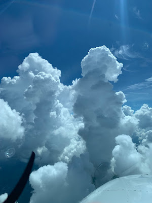
Making my turn at GEF I could see the buildups, they were actually pretty scattered.  The big cloud chimneys looked imposing but between the radar and my eyes I was able to chart a path down the valleys between the cloud cliffs.


Things were changing quickly and I could actually see the clouds boiling up.  While today I mostly relied on my eyes, the onboard radar confirmed my path while the satellite radar was quite misleading.  For example, I ended up sliding between two strong rain shafts near Lake City.  The tops were only in the low teens and at 9000 I was above all but the cores.  Notice that the XM weather is not really showing the quickly forming intense rain nor that pillar of rain at 18 miles that will be just off to my right.


When I say things were changing fast, look at the radar below.  In the scan above I am about 25 miles from Lake city.  Below I am 9  miles so this is about 4-5 minutes difference.  The XM is still hopelessly behind and following it I would have likely strayed very close to the new storm ahead to the right.  In reality, I turned left and split the difference while staying in clear air.


If the rain had been more developed and more vertical, I would have given it much more room.  I did expect a bit more turbulence but by staying out of the buildups, I had a very smooth ride.  


After Lake city I just had one small area of storms to avoid but by this time I was descending and could no longer pick my way visually.  Again the live radar showed a lot more than the XM.


I skirted South of the last rain showers and broke out around 3000.  There was a slow Cessna on the ILS to 32, they were using 23 though but because of the opposite direction traffic, I was going to be vectored around quite a bit.  I don't like cancelling but sometimes it makes everything easy.  I cancelled, the controller handed me to tower and in I went.


They were using 23 but the winds were calm and I was set up for 14 so I asked and was given 14 with a land and hold short of 23.  This worked well and I joined the right base and soon was rolling to a stop on 14.  The controller had given me full length on final but I easily made the 2000' turn off and the plane was soon away in the hangar.