
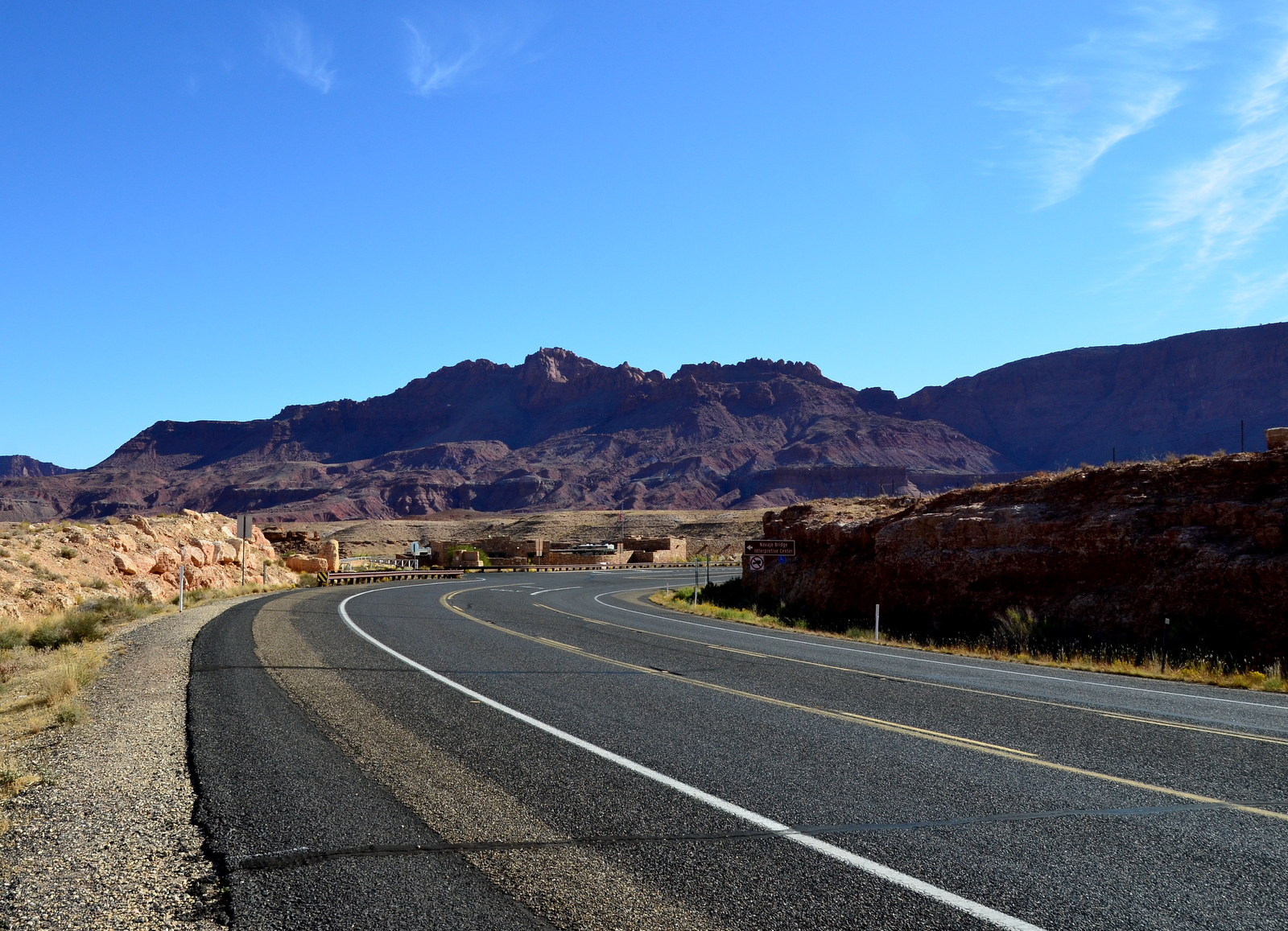
Yesterday I decided not to stop at Marble Canyon, winds were strong, gusty and shifty. Marble Canyon (L41) is only 10 miles from Page. You can drive there but it takes 45 minutes, the roads are not quite direct. Marble Canyon is also one of the few places you can legally land in the Canyon.

As discussed before the Grand Canyon has special flight rules. There are different sectors each with their own requirements. The Marble Canyon Sector has a floor of 7999 feet, meaning you can't fly below this altitude. The airport is at 3600 feet so how do you get there?

There is an exception, you may operate within 3000 feet of the surface within 3 miles of the airport for take off and landing operations. The airport is about 2 miles from the sector edge so you can legally fly into the special flight area just over the canyon rim and descend above the airport.

The runway is bumpy, narrow and the markings are non standard. Non standard as in missing in most cases, It does have a center line, sort of. It looks like it was painted by a drunk person. It is everywhere but the center.
I was glad I waited for the gusty winds to abate. Arriving the winds were calm and the landing went well as I touched smoothly and stayed on the runway. One other feature is that the runway crests in the center so you can't see one end from the other. This makes it look much shorter even though it is 3700 feet long. The runway sorta ends at a taxiway or maybe it just has a dogleg. I pulled into park and shut down.

The ramp is not level. When I started to release the brakes I started rolling backwards. This was useful as I needed to push back into a space but eventually I needed to stop. I had planned ahead. We brought our own chocks so I sent CC to set them while I held the brakes.

We the further secured the plane with extra chocks, I mean rocks that other people had used as chocks and then walked across the street to pay our landing fee. The airport s actually private and it costs $5 to land there. I was happy to pay my fee after landing in the Canyon.

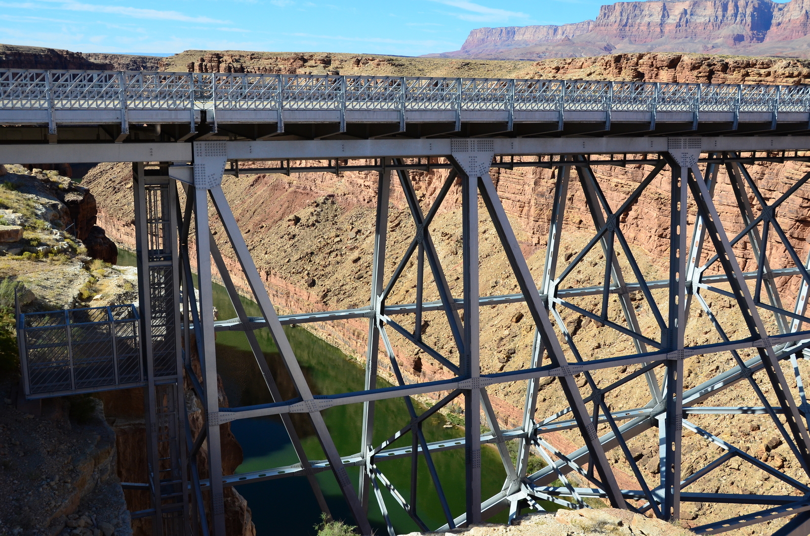
So why did we come, well I wanted to land in the Canyon and it is a challenging strip but it also is next to the Navajo bridges over the Colorado river. The original bridge was built to replace a ferry ride in the 1920s. It was timely as the Ferry sank and for two years you had to drive over 800 miles to cross the river.


The original was bridge was narrow and as traffic grew there was a need to replace the bridge. In 1993 a new modern bridge was built. The old is now for pedestrians to watch the new bridge and the river. Walking the old bridge it is hard to imagine going head to head with a semi as late as the 90s.

Departing was pretty easy, just mind the narrow runway. We did a circle to gain some altitude and then headed out of the canyon. One of the big tourist attractions in Page is flightseeing. They run tour planes over all the local sites. I checked and a ride costs $135 or $185 if you want to sit up front. Sedona had flightseeing too for $100-$150 per person.


I wasn't going to pay when we had our own plane but I did talk to one of the tour pilots on arrival and found out about there operations worked. This way I knew what to look at and to know how to avoid them. Leaving the canyon we took a flight down Lake Powell to see the sites spending much less than $370 and seeing a lot more.


We looked down on Horseshoe bend, the Dam, Massive Butte and Rainbow Arch. After tying the plane down and getting it refueled we headed off for some final sightseeing. We were flying in and around some higher terrain and the GPS units kept warning me to be careful, this is something we typically don't see in Florida.


The Wave is quite famous for its unique rock formations. To visit the site you need to get a special permit and you need to back country hike. The permits are hard to get and in super high demand. We are also not that type of hiker.

Luckily there is the New Wave. It is not as impressive as The Wave but it is just a mile down from the Dam. I had gotten directions off the internet. It is not one of the main tourist attractions. You take a turn off and then two more turns down successively bumpy and dusty roads.

We followed the directions and at the designated spot we parked. There were no signs where to go from there, just the direction to head West .2 miles. We figured that we would invest 400 steps and see. About the time we got to 300 steps we found a marked trail and followed it to the New Wave.

It is smaller and less impressive but I like to look at the ratio of view to work required to get there. It is a high value hike.

We left the New Wave and headed for one final scenic overview of Lake Powell. As we gazed over lake Powell we could also see Utah, it was 2 miles away. It was not planned but we decided what the heck, let's visit Utah.

We hopped on the highway and headed North until we came to a sign. There was a couple on a bike travelling cross country taking a picture when we arrived. He was going to get the bike out of the way so we could snap a picture but I had a better idea. Now I can tell people I biked across the country with CC and have the picture to prove it.

We drove a bit in Utah and looked at the Utah mountains and then it was back to Page to get ready for the trip home. Forecast was for tailwinds but I didn't believe it.
No comments:
Post a Comment