Tuesday, July 12, 2022

Off to Walmart (#22 Arkansas)


I had another class to attend. This time it was in Oklahoma City. Not my favorite place to go in the summer, especially with forecast highs around 102. I had to be in OKC on Monday at 7:15 and given all that can go wrong, I decided  leave Saturday and go most of the way so I could drive the last bit if needed.  I also was also looking to add another state and Arkansas was along the way. Not just Arkansas, but Bentonville, the home of Walmart. Ok to be fair, the Crystal Bridges Museum of American art had caught my eye.

I had been watching the weather and my expectation was for no issues on departure or on arrival in Arkansas. I was concerned a bit about storms along the way, especially by Memphis where we planned to stop for gas.  When I woke, Memphis was getting hit pretty hard and rain was approaching our fuel stop. I had backup ones but I had chosen this stop because it had a great price on gas. Departing the weather was good at home but the rain was about 10 miles North of our stop.


We pressed on and after reaching 10,000 we had a new issue. There was a line of storms forming that started at Montgomery that extended into Georgia. A quick request to ATC and we were cleared MGM KHAB. Problem solved.  Our next problem was headwinds, 30 knots on the nose most of the flight. There was no solution for this other than extra gas. Passing Montgomery we made the turn and it was smooth sailing. While we were busy rounding the storms, the rain at our stop moved on and started to dissipate.

We landed and pulled up to the pump. The plane ahead was still loading and it was like watching a clown car in reverse. Six people squeezing into a Cherokee 6. They were trying to get going but they couldn’t quite figure out the sequence to load. They finally got in and the pilot got the engine spinning after 3 or 4 attempts.  We topped off as the gas was the cheapest I had seen in quite some time. I had a bit of trouble as the hose lock was broken but the manage came by and helped me. I like country airports because they are easy in and out. Departing, Memphis had our clearance and we were soon on our way. I thought I might be rerouted as my track took me right through Memphis class B airspace.

I should not have worried. It was empty, I even called approach once to make sure they were still there. The headwinds were still with us but we soon landed in Arkansas. I had to land long as there were 4 Black Hawk choppers blocking the taxiway I needed. We taxied around and soon had our stuff in the rental car.


After swinging by our hotel to check in and drop our stuff, we headed to the museum. It’s a new museum and it’s pretty stunning. We wandered a bit and took a tour of a Frank Lloyd Wright house they had moved to the site. We strolled through outdoor sculptures and topped it off by seeing a copy of the constitution printed in 1789.

The museum is pretty cool but it is the worst marked facility I have visited. They have great trails but no maps. There are a few diagrams in the museum but they are few and far between. Eventually we figured the place out.  I would recommend it if you are in town, it was very cool to see both new and old American art.


After the museum we headed downtown to see the home of Walmart. We took a quick spin through the Walmart museum. It was more of an add than a museum but it was free. Downtown is quaint but after some walking we headed back to the hotel. We found some tasty BBQ and enjoyed some pork, brisket and ribs. After that it was time to get some rest.

Thursday, June 9, 2022

They Lied!!!

I woke up at 6:30 AM today to stay ahead of the weather.  I might as well have slept in.  I was going down to Marathon in the Keys and back.  The weather was supposed to be clear down South and storms in central Florida after 1 PM or 2 PM depending on location.

Our departure at 8AM was into scattered clouds and we were soon cruising down over Ocala and Lakeland.  The arrival into Marathon was easy and in short order I was heading back North.  I had started with partial fuel and non stop I would have had only a bit over 1 hour reserve for the return.  I skipped the really expensive fuel in Marathon and planned a stop in Wauchula.  They had cheap self serve gas which in theory meant a faster stop.

Crossing the South shore of Florida, I could already see the storms building.  ATC re-routed me over RSW which kept me West of the rain and I was soon planning my descent into Wauchula.  I had the radar running and the little shower South of the field just kept growing.  Checking in with Miami I asked for a descent which got me below the clouds and I cancelled IFR.  I could see the rain and skirted East of the storm, staying dry.  Rounding the edge I had the field and cancelled flight following.

The pump was a new challenge.  I tried to authorize 120 gallons but it had an 88 gallon limit.  No problem, I filled the left tank and shut it off.  I then went to start a new transaction on the right and it said the pump was still in use.  I looked around carefully and no one was using the pump.  I waited a few minutes and then called the office.  They said to wait a few more.  I did and it decided to sell me more gas.  Having mastered the pump, I checked my gas and fired back up.

The radar was showing a good path over Lakeland and then North East.  Airborne, I received my clearance and fired up the radar.  It too showed a path and Miami had cleared me LAL direct home.  All was good until I checked in with Tampa and he wanted me to go North or West after LAL.  That was not going to work and I said I needed East.  He said, that's Orlando's turf and they probably won't take me.  I think he took a hard look at his radar which showed no path to the West.  He came back with good News.

Orlando had accepted me, I could turn due East and talk to the controllers that watch over Mickey Mouse.  They usually don't want piston aircraft but with the storms they made an exception.  Eastbound there was only one cloud in my way which the radar showed as safe.  I was only in the clouds a few seconds and then I was back in clear air.

At 8000 I have been amongst some tall clouds but had stayed outside of anything dangerous.  The controllers plan which looked good on my screens was to pass Winterhaven and then head North.  I did sort of go through one more cloud.  It was a big cloud but it had a hole in the middle so I was able to squeeze through the gap.  Looking back, the storms had turned darker and  I was glad to be through.  

I watched them for a bit after I landed.  They of course started falling apart right about when the forecast said they would start.  In the end it all worked out.  I always had a good escape route which I thought I might need but thanks to the controllers I was able to safely work my way home.

Sunday, June 5, 2022

Chesapeake

I start watching the weather a few days out on a trip. The forecast for Friday had been for rain along the North South Carolina border. It was supposed to start mid day and I had contemplated whether we needed to leave earlier than noon but the morning forecast said no rain before 7 pm so we stuck with our planned 1130 departure.   I had a class to attend Saturday and part of Sunday. Class was scheduled to end at 1300 Sunday so ideally we would arrive around 1500 so we could avoid an extra day of car rental.

Our departure was interesting. We took off runway 14 with a right turn to 280. On course was 20 degrees. This roundabout path was due to some slow moving traffic inbound from the North. On a positive note once we checked in with departure, we were given an immediate climb to 9000. Passing 3000, we were cleared on course. Always fun to make a 240 right when a 120 left would have done. We did confirm that two rights can make a left though…

Other than wasting a few minutes and some gas, I couldn’t complain too much. Weather was good and we only had a slight headwind. We cruised up to Savannah and made a gentle right to head for Lumberton, NC, our fuel stop. We didn’t need gas but I couldn’t turn down a cheap fill up and it gave us some more options for the later flights.  

CC and I had first stopped at Lumberton in 1995 on a trip to Bar Harbor. We had not intended to stop there but heading North the intended airport was low IFR under a storm and Lumberton was clear. We were met with friendly service and since then I have used the airport as a fuel stop multiple times.

Arriving on the ramp, I called on Unicom for gas and soon after shutting down the truck was pumping away. We took a quick break, payed for the gas and fired back up. While on the ground I had checked the weather and during our short stop some storms had started popping. If you believed the forecast, they were both in the wrong place and time.

We were soon cruising at 7000 with a 7 knot tailwind. All was good but we did have some rain ahead. It didn’t look like much on the satellite but the active radar showed some strong activity. Luckily our path took us North of the weather and we just got a nice view.  The sky was a bit hazy as we approached Chesapeake but at about 15 miles we saw the runway and made an uneventful approach. Tie downs were not the best but I got the ropes on the plane and headed in to get our car.

They have a local car rental and I had booked it weeks ago and confirmed it Wednesday. Even so, the car was not there as they had a slight scheduling SNAFU. Luckily, they had a slightly more expensive car which we took.  They were very nice and waived our parking fee which was a bit more than the additional cost of the car. After grabbing some food, it was time to sleep and head to class. 


Saturday, I went to class and CC met up with an old friend and gallivanted about Virginia Beach.  The class was good, but I confess, strolling down the beach on an 80-degree day would likely have been much more fun.  Sunday was only a half day so at Noon we headed back to the airport.


Everything checked on preflight and the weather as far as South Carolina looked stellar.   While it was clear, it was not smooth.  We started at 6k but soon I was ready to try 8k.  8k took us just above the clouds and increased the tail wind but as we headed through North Carolina the clouds melted away and the tailwind became a 14 knot headwind.  


I decided to try 6k again and we picked up a small tail wind netting us about 20 knots but the ride was less than smooth.  We discussed the ride a bit and over time it smoothed out.  Our fuel stop was Allendale, SC.  We have stopped there before, it is known for friendly service, cheap gas, good candy, clean facilities and a slow gas pump.


All the way down we had been watching the remnants of the tropical storm.  There had been a line of rain from Savannah to St. Augustine, but it had been moving West and had started to diminish.  The Savannah controllers were quite helpful letting us deviate around some heavy rain and then putting us just offshore.  As is typical in the afternoon, the land side was dark and foreboding and the sea-side was pretty clear.

We had an uneventful arrival home and soon had the plane away.


Sunday, May 29, 2022

Busy Day Aviating


It started off simply, a quick flight with my dad.  He is getting up there in years, 92 to be exact.  I prepped the plane and CC drove him over so as to minimize ground time.    The plane was out, and after some work and help from the hangar neighbors, we had him loaded and I was running the checklist. We take climbing into the cockpit for granted.  I can see that it will increase in difficulty in the decades to come.

I was about to flip the master on when my mechanic showed up.  This was odd as he had fixed my pressure pumps recently, but I had already made a few flights, and everything was working.  His appearance was soon explained.  A plane had a mishap, and the airport was closed.  

Normally a delay is not an issue and our immediate concern was for the unfortunate pilot, but I couldn’t let dad bake in the heat or we would have a second emergency.  We carefully help him deplane and seated him in the air-conditioned car.  The incident looked really bad at first, the plane looked squashed which is never good.  We soon learned it was not that bad.  The plane had departed the side of the runway and flipped in the soft grass.  The pilot had walked away, shaken but OK.

Later reports from a mechanic that assisted in the recovery indicated that it may have been caused by a locked brake or broken steering linkage.   

I have a portable radio and we listened to ground control.  They were telling planes it may be a while.  I pushed the plane back in the hangar and Dad and CC headed for the house.  Of course a few minutes later they opened the airport.  I called them and they quickly reversed course.  My hangar neighbors were extremely nice and delayed their departure so they could once again help Dad make the climb into the cockpit.  I have to get in first and CC is just not as strong as I, so loading is a bit more awkward.

We had a lovely uneventful flight.  Our route took us by JAX, the old rice plantation and Kings Bay, the submarine base.  Thankfully our landing was smooth, and we tracked the center of the pavement.  We had learned from the first aborted flight and  Dad was able to extricate himself easier by sliding out, and then down the wing before standing.  We headed to the house for lunch and overall was a successful venture even if we made Dad work harder than he expected.  Big thank you to our neighbors that jumped in to help.  Made the boarding much safer.

CC and I were not done aviating though.  I have had a hankering to watch the sun set and test the new settings on my flight displays.  Previously they had been set to a higher value of minimum dimming than I liked.  Bragg Avionics had updated the settings, so it was time to test them.  The blue skies had given way to a high overcast after an afternoon of storms off to our West.

Undeterred, we headed out just before sunset to have a look.  The flipped airplane was parked on the ramp which was how we got the updated pictures.  After surveying the damage and being thankful that it did not happen to us, we headed over to inspect the plane.  Preflight went smoothly, I had prepped the plane earlier so everything was ready, just needed to double check that no one had snuck into the locked hangar and changed anything.

We departed just before sunset and climbed out to watch the sun dip below the horizon.  As usual the colors were stunning, the air was smooth and we cruised down towards Palatka.  The rain was supposed to be gone.  We had major storms 200 mile South but North Florida was supposed to be clear.

As we turned West passing Palatka heading towards Gainesville, CC noted some lightning off to our left.  The satellite radar only showed a small area of rain to our right though.  I fired up the radar and sure enough, that building cloud was painting bright red.  Out of curiosity I asked the controller what he showed.  He initially said, just light with some moderate rain.  This was what the satellite was saying and based upon that picture, I would have flown that direction.

The radar was painting severe, and we were getting a nice lightning show.  The controller then said his latest update was showing extreme precipitation.  Eventually the satellite caught up with reality.  That little bit of rain to our right, well it too was deceptive.  Very little rain falling to the ground and looked benign on the satellite but it had a core of strong rain and I would have avoided it had it been on our route.

It was soon time to turn North and head home.  We left the light show behind and the last light faded and we were enveloped in darkness.  The new screen adjustments worked though there was some user adjustment to tweak the displays to get them to my liking. 

We finished the flight by cruising over downtown and then set up for a straight in to 14.  I was a few knots fast and decided to stay off the brakes, so we rolled to the 3000’ turn off and cleared the runway.  Was a nice way to end a great day of flying, tower had me monitor ground as we taxied back to the hangar.  The plane was soon secured and ready for our next flight.   

Saturday, May 21, 2022

Back to School

In 1986 Rodney Dangerfield returned to college with hilarious consequences.  Yesterday I headed back to radar school.  Lots of weather South of Orlando but clear up by us.  One area I have struggled with is tilt management past 40 miles. 

I have been studying and was ready to put the lessons to some practical use.  The first important consideration is how far away the horizon is.  As you climb, the distance to the horizon increases.  (Yes the flat earth folks will argue this point.) 

Altitude (ft)        Horizon (NM)    Ground Range

2000                       47.6                        35
4000                       67.3                        50
6000                       82.4                        62
8000                       95.1                        75

With the dish tilted down, the radar gets ground reflection.  So at 2000 feet you would expect to see ground returns out to 47 miles.  You don’t though.  They stop about 75% of the way out.  The reason for this is that as you get farther away, the angle of incidence of the beam gets shallower.  As it gets less than 2 degrees, the energy no longer bounces back.

This means that depending on the distance and your altitude, you may not be able to confirm attenuation for farther off storms.  This all assumes flat ground, a city for example provides flat surfaces to return energy.  Also, since buildings are tall, they can reflect even when they are technically over the horizon.  A 100-foot building effectively increases the distance 10 miles, a 200 footer adds 17 miles. 

How do I know this all works, I went and flew at 2,4,6, and 8k while tilting down to paint the ground.  This worked well and I was easily able to tilt down and paint ground from 5 miles out to the values above.  As you tilt the dish up you lose the ground.  At 8000 for example, 3.5 degrees up paints some ground around 60 miles.  Everything beyond this is weather or something tall on the ground. 

The key to seeing storms father out is to keep most of the beam off the ground but not so high that you scan above the weather.  It’s easy to over tilt.  A 6 degree up has the bottom of the beam 2 degrees above the horizon.  At 100 miles the beam is 18,000 feet above your altitude or 26,000.  This also ignores the fact that the earth has curved away from you about 8000 feet as well so you are really scanning around 34,000 feet.  Easy to miss serious weather that is not a monster storm.  Also at that level the water is likely frozen and does not reflect as well.

After working ground returns, I focused on weather.  I have been trying to get better at that 80 plus mile range.  One tool I am still learning is VP (Vertical Profile).  In this mode you set a bearing and the dish scans up and down.  This eliminates the tilt issue.  You will always see the ground out to the distance previously discussed.  Anything else is a storm or a ground object.  

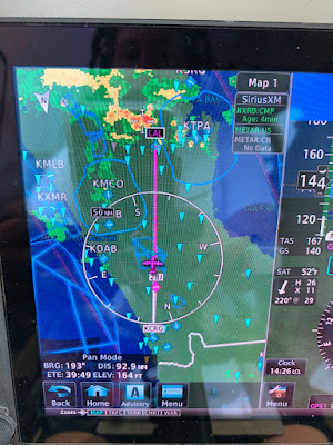
Above is an example of VP pointing towards clear air from 8000’.  Below is looking at weather, the storm at around 105 miles is clearly visible and matched the XM weather data.